
The Core Technology
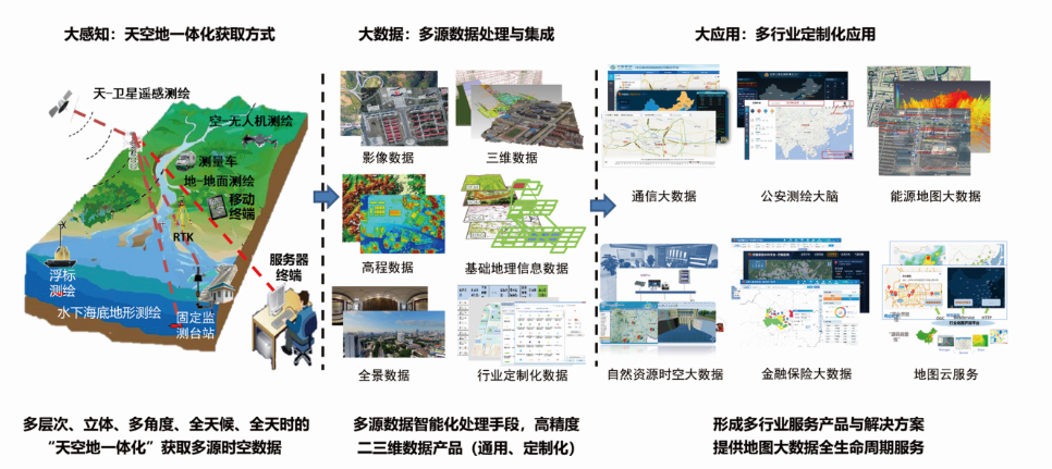
天空地一体化数据采集
Under the background of new surveying and mapping, based on remote sensing and photogrammetry, GNSS, multidimensional space-time GIS and other technologies, Combining the customized needs of various industries, Mapuni has provided a “space-air-ground” integration data acquisition solution, and provided integrated services for data processing, data integration and data application throughout the whole life cycle of the data. In the meantime, we have also provided multi-source, multi-dimension, multi-scale, multi-temporal, multi-structure integrated high-precision spatial data products, and have done data solutions experts in various industries.
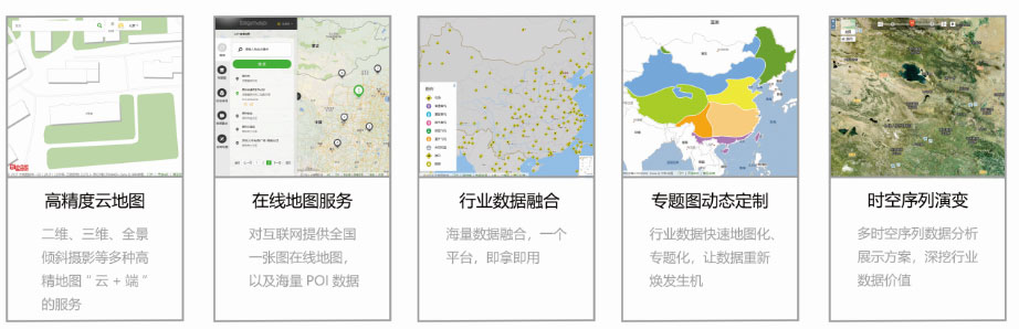
地图大数据服务平台
The product has been characterized by time series, space sequence, knowledge sequence and multidimensional geographic big data, supported by isomorphic internet, mobile internet and cloud computing technology. It has adopted a unified service platform system, had high data fusion features, with multi-source heterogeneous space data and non-spatial data compactly integrated, business data and internet data efficiently spatialized. It has provided simple and efficient second development, and quickly built map big data industry applications based on GIS.
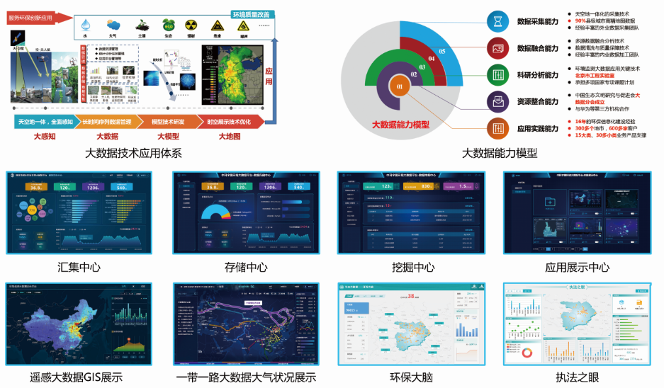
生态环境大数据
The big data platform of MAPUNI map ecological environment mainly relies on large data and large map data resource pool, which provides large data operation and maintenance management of environment and large data analysis application of environment, and comprehensively promotes the integration, sharing and analysis of environmental data resources.
精准治霾智能化调控解决方案
On the basis of three-dimensional monitoring and big data analysis, based on "8721" project, Mapuni has established a set of business process at the core of “three-dimensional monitoring, precision evaluation, target control and scientific evaluation” for the prevention and control of air pollution, and has built the work model of precise prevention and control, intelligent control and scientific evaluation for air pollution to provide technical support and management means for the precise treatment of urban haze.
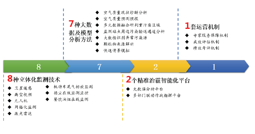
- With the three-dimensional 8 monitoring methods of "satellite remote sensing + UAV + ground monitoring", we comprehensively monitor the concentration of pollutants and the status of pollution sources, realizing the integrated three-dimensional monitoring of the sky, and solve the problem of "inadequacy of coordination in the three-dimensional monitoring system".
- Using the environmental big data analysis and air quality model prediction as a means to conduct 7 kinds of data analysis and judgment, comprehensively diagnose the air environmental problems, establish the big data and model analysis system, and solve the problem of “inadequate environmental situation analysis”.
- Build two platforms, the "big data analysis platform" and the "multi-department joint action combat command platform", to carry out professional regulation and control planning on the basis of "normal, emergency, and long-term effects", based on the air pollution prevention and control business line and the expert consultation regulation system, propose the scientific, efficient and economical prevention and control measures to solve the problem of “no basis for emission reduction and source control measures”.
- Establish a set of "Precision of Haze Governance " working operation mechanism and based on the core of consulting services to establish an expert group protection mechanism; taking the effectiveness evaluation as the core, and set up an effectiveness evaluation mechanism; taking the implementation of measures as the core, establishing a performance evaluation mechanism to solve the problem of “incomplete supervision and inadequate implementation”.
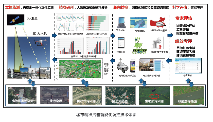
The intelligent control solutions for urban precision of haze governance
 京公网安备 11010502037899号